Reviewed by F. E. Romer, East Carolina University (romerf@ecu.edu)
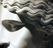
The document in question is still familiarly known as the Tabula Peutingeriana (Codex Vindobonensis 324), and Emily Albu calls the tabula a "map," which establishes her stance on the document. The Romans had no single word for map and no clear starting-point among them for what moderns often consider map-making. We now know enough to agree with her that it is a map, although that point used to be—and can still be—debated until the function of large-scale ancient maps is understood better. The major questions that have haunted the Peutinger since its discovery ca. 1500 are where and when its prototype was produced (the artifact is demonstrably a copy); from what sources the prototype was compiled; and where and why it was reproduced in the late- 12th/early-13th century. Albu addresses these questions and much more. "While our map . . . continues an older mapping tradition, its production speaks directly to its own contemporary concerns, deeply engaged in the cultural and political issues of its own day" (2). She refocuses the debate by asking herself explicitly, What is the exact origin of the medieval artifact known as the Tabula Peutingeriana, and why was it produced? The book is divided into seven chapters treating: (i) the Peutinger map as a medieval artifact; (ii) Roman roads and Roman perceptions of space; (iii) "the battle of the maps" (31), which analyzes competing Christian and secular, especially Carolingian, views of the mappable world and tries to decide if the Peutinger map reflects a Carolingian prototype or intermediary; (iv) Christian maps in relation to the Peutinger map, with an eye to the Hereford Map, Matthew Paris's route maps, the Gough map of Britain, and various mappaemundi; (v) the role of German emperors, the crusades, and Swabian monasteries in imperial map design; (vi) images and medieval maps; and (vii) Roman roads and romanitas highlighted by the medieval map within the Holy Roman Empire. The front matter includes a list of the 28 black-and-white figures, a list of the 8 color plates, and acknowledgments, while the end matter contains twenty-seven pages of notes, a dozen pages of works cited, and a basic index. Three periods are to be considered: the Roman Empire of the late third, fourth, and fifth centuries, a likely period for producing the prototype; the Carolingian renaissance, another likely period for the prototype or an important intermediary; and the medieval interval ca. 1175-1225, to which paleography ascribes the artifact. Albu minimizes the possibility that the prototype was pre-Carolingian and sees no reason to assume that it was assembled in the Roman era. No firm evidence indicates anything like a true mappamundi in the Roman world, and mappamundi is apparently a Carolingian coinage. Albu rejects a recent argument that the Peutinger map originated ca. 300, and does not scrutinize the sources that underlie it, some of which go back at least to the first century. It would be rash to assume that sources so old were not compiled before the late-8th/early-9th century. For example, the map names and locates Oplontis (a hapax legomenon), unknown after Vesuvius erupted in 79, undiscovered until the 18th century, and unexcavated until the 1960s; and note, too, the absence of the Via Nova Traiana. Other material may even be earlier; see, for example, the equal prominence given to Bostra, Damascus, Philadelphia, and Petra in Western Asia, although Petra had declined markedly during the first century. Albu devotes her energy to the Carolingian era and the medieval interval, but argues such that the reader may believe the prototype emerged in either Roman or Carolingian times. In the fourth century, she contends, cultural shifts caused by the spread of Christianity attracted new mapmakers contemplating the divinely ordered universe and intending to subvert Roman secular claims to worldly dominion, which led to what Albu calls the battle of the maps. The universalizing Roman view of the world was adopted, and adapted, by Christian intellectuals, providing the catalyst that "subtly changed the Roman itinerary mind into a mapping mind that imagined and depicted the world in a different way" (32). Albu is concerned with the clash, and its consequences, between the claims of secular and religious imperium, which caused a major shift in how individuals perceived their personal identity. "Early Christian world maps, in all their varieties, suggest just how profoundly Christianity altered Roman concepts of space within the empire and beyond its borders" (40), but only the Peutinger exhibits the Roman secular viewpoint. The battle of the maps contested ideas of cosmic universalism, the meaning of imperium, and the symbols of power and authority, and disputed who rightfully possessed the earth and its privileges—the emperor and his agents or the Christian peoples and the Church. The coronation of Charlemagne as Holy Roman emperor brought these questions to a head. Charlemagne's geographical curiosity, interest in maps, far-flung diplomatic connections, and imperial ambitions, along with his well-known antiquarian interests, combined to motivate the creation of a map, which promised the restoration of Roman imperial power and led its viewers to envisage an itinerary of geopolitical power. "It seems to me likely that during the reign of Charlemagne (d. 814) monks at Reichenau produced a map in the Peutinger line of transmission, perhaps even the prototype" (54) but "at least a Carolingian mediator, though multiple intermediaries would also be possible" (48). For her, both the lost intermediary (her prototype) and the extant map emerged, centuries apart, from the scriptorium at Reichenau—an abbey that was at the center of the Carolingian monastic revival, had a long history of anti-papal propaganda, and was still active in the 13th century. She argues against the whole background of Western (= Latin) cartographic development, examining mapping traditions that both contributed to and emerged from the Carolingian renaissance. The result is a complex intellectual jigsaw puzzle. All those roads that famously led to Rome also led outward and laid claim to the outside world as the possession of the Roman imperium, and their existence and upkeep marked their military, economic, social, and political importance in the Roman imperial scheme. The roads facilitated movement of persons and goods as well as the communication of information and ideas. "As the emperors fully understood, Roman roads sustained the pax Romana . . ." (21), and thus itinerary lists came into existence and grew in informational value over time, while the development of maps and mapping was stunted. Yet there were two sides to what Vergil described as imperium sine fine: "While Roman travelers imagined their world as a nexus of linear paths from site to site, the intellectuals among them were drawing a mental image of the whole universe" (24). The familiar imagery of urbs/orbis connected the city of Rome to the world empire and helped to make the globe its symbol. Albu argues that the Peutinger was not intended for use by travelers and that it does not simply copy a Roman map based on itineraries. She takes the minority view that the map was intended for display. (The artifact has pin holes.) She believes that Rome was located virtually at the physical center of the artifact before it lost its first leaf or leaves, but this is a difficult interpretation by any standard. Considering its prototype not ancient, Albu questions the supposed early influence of the Peutinger on medieval mappaemundi, even suggesting, inter alia, the possibility that most influence went the opposite way. Throughout, Albu argues for the use of itineraries by Carolingian and medieval mapmakers, which is always a disputed question. She considers the Hereford and (lost) Erbstorf maps, notes that Roman roads are on the mind of Matthew Paris, and suspects "that the Peutinger prototype was a later entry in the mapping competition ignited by the powerful assertions of the Christian worldview" (70). It combined ancient Rome and the newly restored imperium into a composite whole as an alternative to Christian world maps. Distinctive features on the artifact draw attention to the crusades, to German and especially Hohenstaufen ambitions, and to Roman imperial claims against Byzantium and the rising imperial papacy, which became entrenched after 1152 when the German princes elected Frederick I Barbarossa "King of the Romans" (then the title of the German king). Barbarossa, Henry VI, Frederick II, and various supporters took up the struggle against the papacy. Albu threads her way through the intricacies of both Hohenstaufen and papal claims. The mid-12th century revival of Roman law and the synthesis of canon law, both occurring in Bologna, raised the stakes. "Each armed with his own legal proofs, pope and emperor affirmed supreme power as his own" (79). Barbarossa's eastward view and dream of uniting the eastern and western halves of the old Roman Empire were reignited when Jerusalem fell to the Turks in 1187, but, after joining the Third Crusade, he drowned two years later. His legacy passed through his son Henry VI, and Henry's youngest brother Philip, to Henry's son Frederick II, who "inherited the dynasty's imperial ambitions" (81). Meanwhile, "papal assertions of supremacy . . . reached new levels of intensity with Innocent III (1198-1216)" (83). The lost Padua map (a sister map resembling and overlapping with the Peutinger); Charlemagne's interest in the Holy Land and Byzantium, and especially his imagined travels to Jerusalem and Constantinople; the legends of Prester John; the romance of Alexander the Great; and perhaps even the memory of Muhammad al-Idrisi's great silver world map (finished in 1154 for Frederick II's Norman grandfather, Roger II, but subsequently destroyed); all contributed to Frederick II's imperial ambitions. Curiously, three larger personified vignettes appear on the map for Rome, Constantinople, and Antioch. Instead of the familiar female tychai, these figures are reworked into males (Rome still with traces of an original female breast). The most imposing is Antioch (perhaps a late insertion), which connects to the crusades and other complex Hohenstauffen interests in expansion. "On this map the ancient tychai have transformed into imperial figures, placed at strategic cities and conveying this message: the emperor rules his Roman domain. Whatever their appearance on an earlier version of the map, on the surviving medieval map the personified images have appropriated some qualities from the medieval mapmaker's world" (101). All three androgynous figures show "the soft features and especially the pageboy locks of Frederick [II] as he wished to be presented" (102). Until Albu framed her investigation, no one had focused as keenly on the medieval artifact, its deep historical context, and the actual circumstances of its production. Her argument justifies her main hypothesis, which is that at the end of the long 12th century (ca. 1050-ca. 1229) the Peutinger map was produced from a centuries-old Carolingian tradition of secular mapping and appeared during the then-current Hohenstaufen rivalry with the papacy. The artifact is, then, a late product of the so-called 12th century renaissance, and the evidence leads her "to assign the map's production to agents or friends of the Hohenstaufen court, within a decade or two following the Fourth Crusade" of 1202-04 (72), perhaps as late as 1220 "when Pope Honorius III (1216-27), successor to Innocent III, crowned Frederick [II] emperor of the Romans in Rome itself" (115). The map belongs to Hohenstaufen propaganda and "stirs a memory of the ancient Roman Empire, whose magnificence and might the German Roman emperors invoked and envisioned as theirs to hold again" (122). This is an original and important book. Albu rather cavalierly minimizes the likelihood of a late Roman prototype; but her analysis of the Carolingian possibilities is convincing; and her argument for the Hohenstaufen context is compelling. The pieces of her jigsaw puzzle fit together, some more tightly than others. She has convinced me that, at least, an important Carolingian intermediary did exist. The artifact's romanitas, like the intermediary's, represents the claims of secular imperium over those of the Church's imperium in a renewed battle of the maps. Emily Albu has raised her hypothesis to a theory and given us a great deal to think about; whether her theory will hold the field, and for how long, remains to be seen.


Interesting that R. does not comment on the significant differences between A.'s conclusions about origins and those of R.Talbert in the last major work on the TP (Rome's World, 2000). There's a long-standing history to that (friendly) scholarly disagreement, e.g. in Talbert, R. J. A., & Unger, R. W. (2008). Cartography in antiquity and the Middle Ages: Fresh perspectives, new methods. Leiden: Brill (http://www.worldcat.org/oclc/647892428).
ReplyDelete